


Few monthes ago we decided to develop LoRaWAN based GPS tracking solution for rivers/seas coastal areas with intensive shipment using Open Source Code.
Here results of our first test setup.
First of all the closest sea for as located in > 1600 kilometers so we tested it in city environment.
Base stationRaspberry pi + SX1301 shield was used as LoRaWAN gateway.
It was placed on the balcony of 25th floor of building:
Hardware was designed by myself.
First iteration - STM32L0 + SX1276 + SIM68. Typical set of components, I would say.
Second iteration - STM32L0 + SX1276 + MT3339 as attempt to reduce self cost of Node.
Packed in waterproof enclosure (because of river/sea usage for):
Powered by 12V battery and being placed in car:
LoRaMac-Node being used with few changes:
- protobuf used to pack payload;
- FuOTA implemented to update firmware over the air (not works stable enough yet unfortunately);
Chirpstack was adopted to use it for GPS application:
- payload storage implemented;
- OpenStreetMap layer added to display track points;
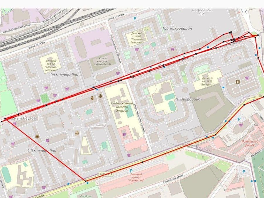
Here what we got:
https://track.m2m-tele.com/#/organizations/2/applications/2
user/password - guest/guest1
First testHere what we got:
> 1.5 kilometers far away signal was catched.
Improvements to be implemented- Getting Fuota working much stable than now;
- Decide what power supply is convenient for GPS tracker being placed on ships.
Keep updates of the project at our telegram channel

Comments
Please log in or sign up to comment.